Skip to main content
University Library Digital Collections
Menu
User account menu
Log in
Main navigation
Browse
Breadcrumb
Home
Search Results
Institution
University Library, University…
(1)
Institution Subdivision
University Archives and Special…
(1)
Fonds/Collection
Map Collection
(1)
Related Item (Is Referenced By)
Related People and Organizations
The Chief Geographer's Office
(1)
Resource Type
Cartographic
(1)
Genre
Maps
(1)
Subject
maps
(1)
Continent
North America
(1)
Country
Canada
(1)
Province
Region
County
City
City Section
Geographic Subject
(-)
Arctic Ocean
(1)
South Saskatchewan River
(9)
North Saskatchewan River
(4)
Saskatchewan River
(3)
Prairie River
(2)
Regina
(2)
River Dee
(2)
Touchwood Hills
(2)
Arctic
(1)
Bear Lake
(1)
Canada
(1)
Farm Land
(1)
Frog Lake
(1)
Lake Ontario
(1)
Lake St. John
(1)
Last Mountain Lake
(1)
Madawaska River
(1)
Manitou Beach
(1)
Mississippi River
(1)
North America
(1)
Onion Lake
(1)
Pipestone Creek
(1)
Prince Albert National Park
(1)
Qu'Appelle River
(1)
Qu'Appelle Valley
(1)
Red Deer River
(1)
Rivière Saskatchewan Sud
(1)
Souris Valley
(1)
United States
(1)
Waskesiu Lake
(1)
Date Created
Date Range
(-)
1920-1929
(1)
1870-1879
(1)
Publisher Name
Search Results
1920-1929
Displaying 1 - 1 of 1
Results per page
5
10
25
50
List
Grid
Sort
Relevant ↓
Relevant ↑
Title ↓
Title ↑
Date Created ↓
Date Created ↑
Displaying 1 - 1 of 1
Sort by
Relevant
Title
Date Created
Order
Asc
Desc
Items per page
5
10
25
50
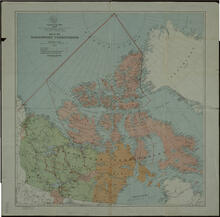
Map of the Northwest Territories
Resource Type:
Cartographic
Institution:
University Library, University of Saskatchewan
Member of:
Map Collection
Date Published:
1929